Tahoe COMMUNITY weaves wildlife with urban-life
…living in gratitude to the water, land and air we are all blessed to share.
Geotourism adventures that highlight COMMUNITY
Tahoe Forest Stewardship Day
Volunteers of all ages and skill levels are invited to this fun, hands-on restoration day. By pitching in, you are improving the watershed habitats that surround Lake Tahoe. Healthy forests act as natural pollution filters to Keep Tahoe Blue.
Participants at the Spring Tahoe Forest Stewardship Day will assess the work done last year in the Angora Burn area and continue improving trails and thinning brush to give light to young trees. A light breakfast, refreshments and a prize will be provided to all volunteers. Check for next Forest Stewardship Day at keeptahoeblue.org/tfsd-spring
Participants at the Spring Tahoe Forest Stewardship Day will assess the work done last year in the Angora Burn area and continue improving trails and thinning brush to give light to young trees. A light breakfast, refreshments and a prize will be provided to all volunteers. Check for next Forest Stewardship Day at keeptahoeblue.org/tfsd-spring
Snapshot Day
Capturing the water quality of the Tahoe and Truckee River Watershed
hands-on water quality monitoring of our watershed to assist restoration projects and watershed protection.
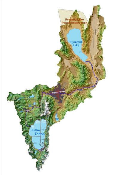
Snapshot Day covers as much geographic area as possible in order to capture a “snapshot” in time of water quality for the entire Truckee River watershed. Samples are taken from the Lake Tahoe Basin and follow the Truckee River watershed all the way to Pyramid Lake (see map below). To view Snapshot Day monitoring locations in Google Maps, CLICK HERE.
For data from previous Snapshot Day Events CLICK HERE.


